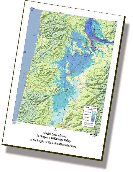
Lake Allison Map
Named for Ira Allison who documented many erratic boulders in the Willamette Valley, this temporary lake filled the entire Willamette Valley (from Portland to Eugene) to the 400 foot level during the height of the GigaFlood.
Water elevation levels are in 100 foot increments with major cities and towns shown. Beautiful for home or office display. An excellent teaching visual aid for school settings or outdoor geology classes. People delight in finding out how deep the water would be over their home.
Lake Allison Map 18” x 24”
$30.00